Each year, we take the tour itineraries we develop for the Great Waterfront Trail Adventure and post them here as trip-planning resources. Now you can experience Great Waterfront Trail Adventures on your own self-supported tour. Maps and itineraries are free to print and download.
Make sure to check our closures and notices page in advance of your trip.
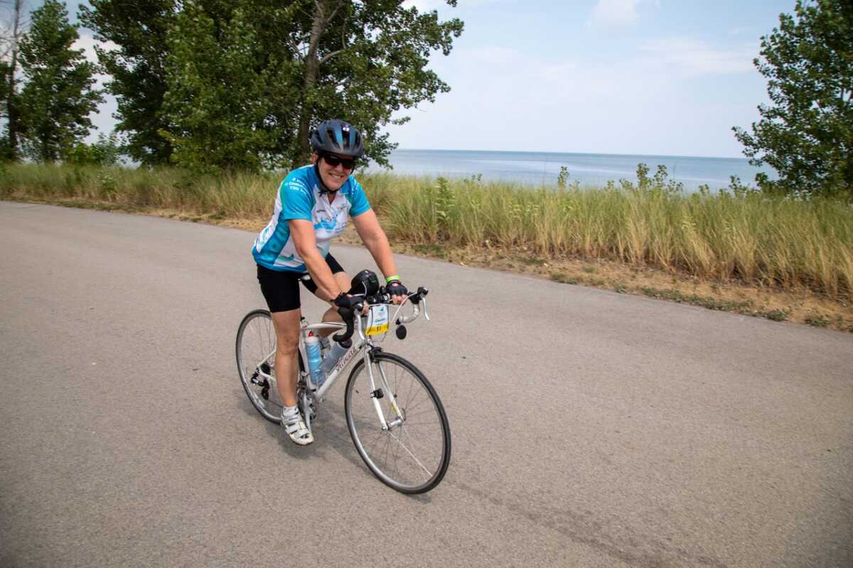
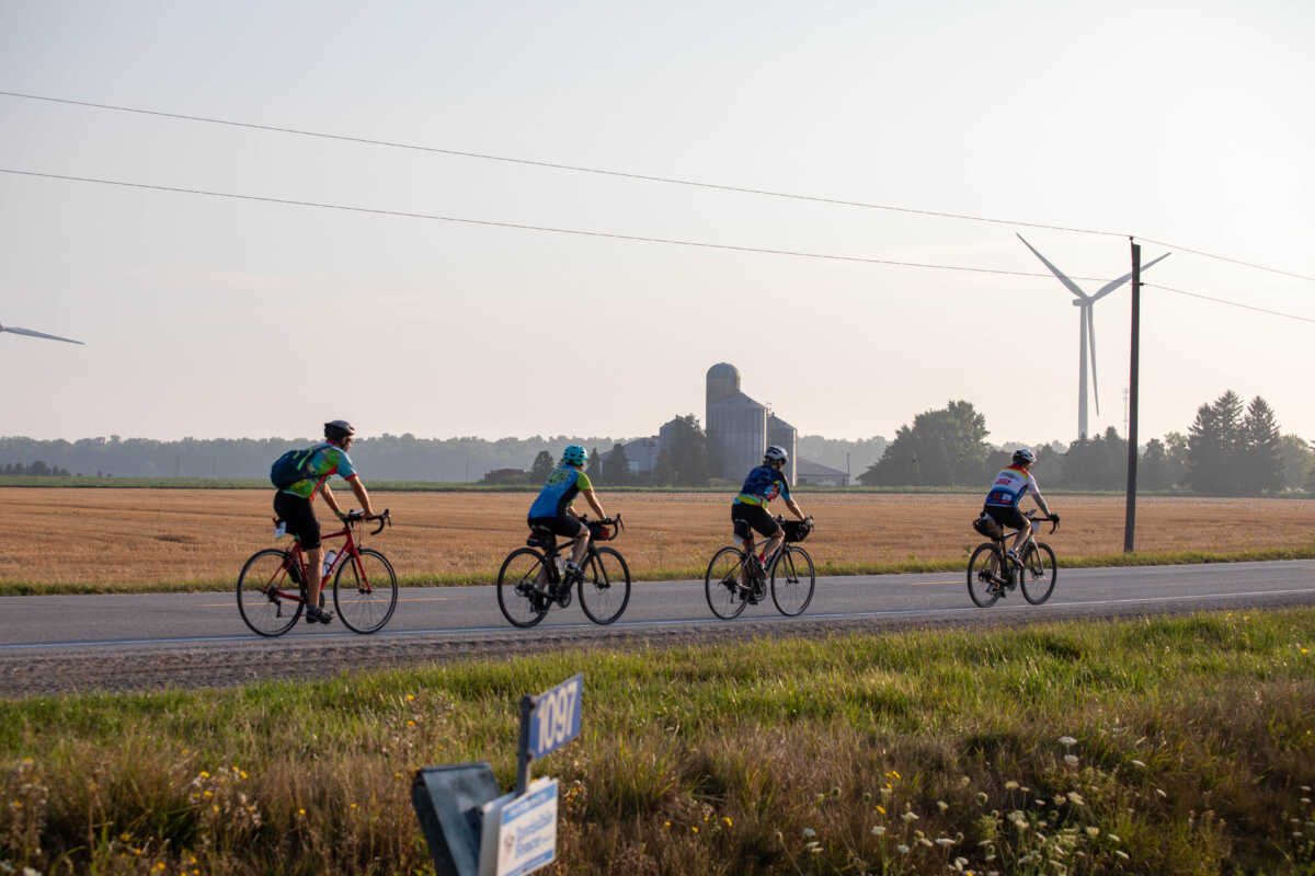
 Based on GWTA 2025 – Loop Route that connects to 3 Great Lakes: Ontario, Huron and Erie
Showcases some of Ontario’s best scenic cycling infrastructure, including the Great Lakes Waterfront Trail, Greenbelt Route, Hamilton’s Keddy Trail, Guelph to Goderich Trail, London’s Thames Valley Parkway, the Whistlestop Trail, St. Thomas Elevated Trail, Port Dover to Hamilton Rail Trail, and the Trans Canada Trail. The route offers a rich blend of natural beauty, vibrant community experiences and the opportunity to take a dip into three of Canada’s four Great Lakes—all in a single week.
![]() 97% GWTA 2025 Tour Participants would recommend the route.
97% GWTA 2025 Tour Participants would recommend the route.
“The G2G trail (while challenging) was extremely rewarding to complete. I also really liked Grand Bend & Port Stanley. With Grand Bend you had a busier vibe and Port Stanley was more laid back. I think having a blend of the two places was very nice and two of my favourite spots on the trip! London & Guelph were nice as well to have a blend of bigger cities mixed in with the smaller towns throughout the trip. I appreciated that part of the ride.”
Great Lake(s): Lake Ontario, Lake Huron and Lake Erie
Total Distance: 685 km (426 mi)
Daily Distance: 41– 110 km (54-83 mi)
Suggested Duration: 9-10 days
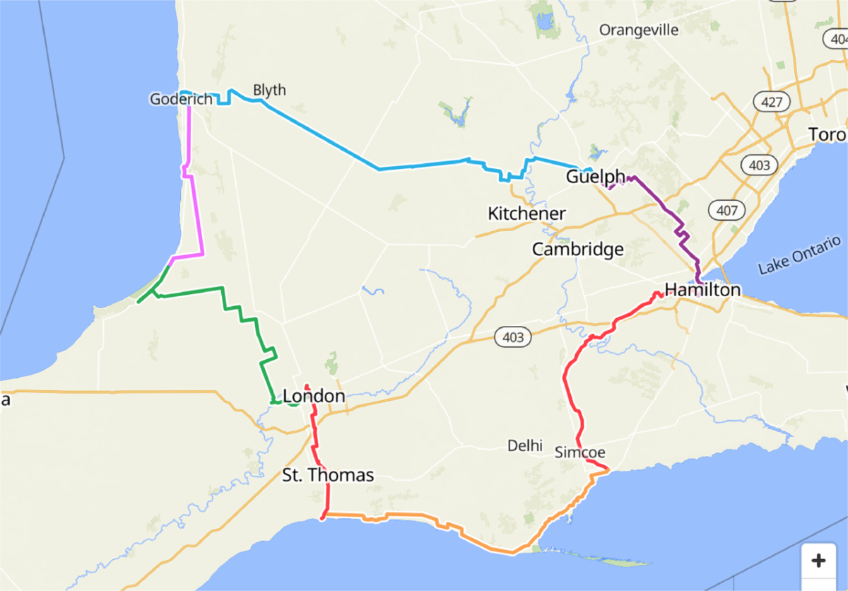
Suggested Overnights: Hamilton, Guelph, Blyth and/or Goderich, Grand Bend, London, Port Stanley or Port Burwell, Port Dover and Hamilton.
Terrain & Route Overview: Combination of quiet country roads and off-road multi-use trails. There are sections leaving London on busy streets with narrow shoulders. There are a few short detours onto County Roads to avoid scheduled trail construction. Unpaved trail sections are screened limestone and firm. Mostly flat, there are some steeper inclines, especially in Norfolk County. The Guelph to Goderich rail trail – surface is mainly crushed limestone some sections may be slightly rougher – this is a well used and well maintained trail for the most part between Guelph and Blyth – after Blyth there are two trail closures with full road detours. Port Dover – Brantford- Hamilton rail trail – surface is varied with some earlier sections paved. Road bikes have ridden this on previous GWTAs.
Overview Description: Loop route that features some of Ontario’s best on and off-road cycling infrastructure and trails, including the Great Lakes Waterfront Trail, the Greenbelt Route, the Guelph to Goderich trail, London Ontario’s Thames Valley Parkway and the Port Dover to Hamilton Rail Trail.
- Itinerary highlights:
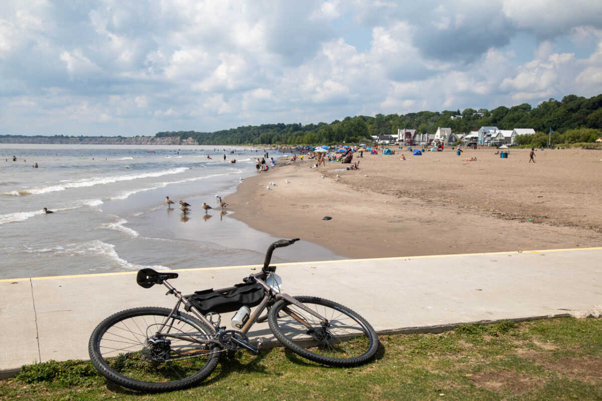
- A lakeside lunch at Baranga’s on the Beach (Lake Ontario, Hamilton)
- Guelph Downtown or the Guelph University Arboretum tour
- Dinner at The Boot in Blyth or enjoying Goderich’s Celtic Festival
- A Lake Huron sunset on Grand Bend’s beach
- Exploring London’s River District, with dinner at the London Bicycle Café
- Dinner at GTs on the Beach in Port Stanley
- Wine tastings at Burning Kiln Winery and a stroll on Port Dover’s beach
- Mohawk Chapel Indigenous Heritage Stop
- Hearts Content Organic Farmstead
Day One: Experience Lake Ontario (41 km)
- Cycle ride to the Lake Ontario Waterfront – utilizing the Hamburg Loop. Those who don’t wish to ride from Mohawk College can park at Barangas on the Beach for a short casual ride long the Great Lakes Waterfront Trail to Burlington.
- Lunch and swim at Barangas on the Beach restaurant.
- Ride back to Mohawk College using the City of Hamilton’s excellent cycling infrastructure.
- Accommodations:
- Staybridge Hotel, 20 Carolin Street South Hamilton, ON, L8P OB1.
- Mohawk Residence on 245 Fennel Ave. West
- No camping.
Day Two: Hamilton to Guelph (66.6 km)
- Ride the Greenbelt Route from Hamilton to Guelph
- Optional post dinner activities including Arboretum tour and Downtown Guelph.
- Accommodations:
- University of Guelph residence
- Delta Inn, 50 Stone Rd W, Guelph ON. tel:519 780 -3700
- *Camping- Guelph Lake Conservation Area, 7743 Conservation Rd RR4, Guelph, ON N1H 6J1 (12 km from Delta Hotel)
Day Three: Guelph to Blyth (110 km) or Goderich (141 km)
- Ride the Guelph to Goderich (G to G) rail trail.
- Please note that there are a couple of G to G bridge closures necessitating detours between Blyth and Goderich.
- Accommodations:
- Hotel Lux 197 Dinsley Street, Blyth, Tel: 519 450 8589
- Blyth Inn, 422 Queen St, Blyth, Tel: 519 523 9381
- Blyth Municipal Campground, 377 Gypsy Ln, Blyth, ON N0M 1H0
- Comfort Inn & Suites -135 Gibbons St, Goderich, ON N7A 3J5, tel:(519) 440-0215
- Bedford Hotel -92 Courthouse Square, Goderich, tel:(519) 524-7337. No elevator.
Day Four: Blyth (100 km) or Goderich (74 km) to Grand Bend.
- Blyth riders will ride through the community of Ben Miller to avoid bridge closures in Goderich.
- Ride through the beautiful Lake Huron community of Bayfield with many options for coffee or lunch.
- Enjoy a Lake Huron Sunset beach in Grand Bend.
- Accommodations:
- Colonial Hotel, 1 Main St W, Grand Bend, ON, N0M 1T0, (519) 238-4000
- Pine Dale Motor Inn -107 Ontario Street South, Grand Bend, Ontario, Canada N0M 1T0, Tel: 519-238-2231
- Blue Water Motel – 121 Ontario St South, Grand Bend, Ontario,N0M 1T0 , Tel:1-519-238-2014
- Camping- Pinery Provincial Park, 9526 Lakeshore Rd, Grand Bend
Day Five: Grand Bend to London (100 km)
- Ride through quiet country roads towards London. Some roads with little to no shoulders.
- Join the Thames Valley Parkway Trail to ride off-road all the way into our overnight accommodations at Elgin Hall University of Western Ontario.
- Dinner in the River District featuring the London Bicycle Cafe and other great restaurants nearby.
- Accommodations:
- University of Western Ontario residence rooms–May to mid-August only.
- *Camping – Fanshawe Conservation Area, 1424 Clarke Rd, London, ON N5V 5B9 (9 km from Elgin Hall–Western University Residence).
Day Six: London to Port Stanley (55 km)
- Leave London via the Thames Valley Parkway Trail and the paved shoulders on Ridout Street.
- Check out the St. Thomas Elevated Trail before taking the Whistlestop Trail in St. Thomas.
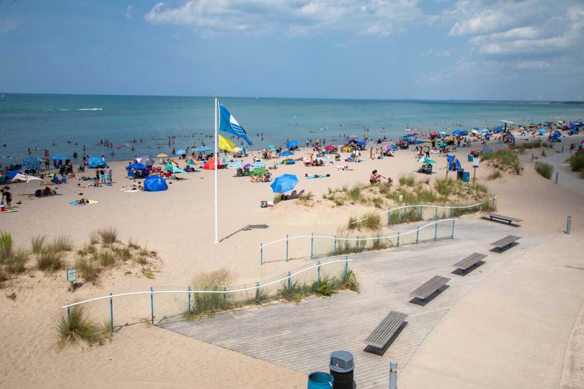
- Lots of time to enjoy Port Stanley’s Blue Flag beach.
- Dine at GTs on the Beach in Port Stanley.
- Accommodations:
- Port Stanley Beach Hotel,128 William St, Port Stanley, ON N5L 1E2 , tel: (226) 658-4024
- Inn on the Harbour 202 Main St., Port Stanley, te. (519) 782-7623
- Kettle Creek Inn, 216 Joseph St Port Stanley tel. 782-3388
- * Port Burwell Provincial Park, 9 Wilson Ln, Port Burwell, ON N0J 1T0 (on the Waterfront Trail, 38 km from Port Stanley, the recommended overnight.)
Day Seven: Port Stanley to Port Dover (108 km)
- Visit the Lake Erie port towns of Port Bruce, Port Burwell, Port Rowan and Port Ryerse.
- Stop at en route wineries.
- Accommodations:
- Erie Beach Hotel ,19 Walker St, Port Dover, ON N0A 1N0, Tel:(519) 583-1391
- Camping Turkey Point Provincial Park, 194 Turkey Point Rd, Turkey Point, ON N0E 1T0 (20 km west of Port Dover and will increase the distance of the last day’s ride)
- Glamping –Long Point Eco-Adventures, 1730 Front Rd, Turkey Point, ON N0E 1P0 (20 km west of Port Dover and will increase the distance of last day’s ride)
Day Eight: Port Dover to Hamilton (100 km)
- Ride the rail trail between Port Dover and Hamilton – rest stops at The Windmill Country Market, Mohawk Chapel , Hearts Content Organic Farmstead.
- Finish in Hamilton
Note about Accommodations: Hotels available in all overnight communities. Our suggestions reflect supported accommodations on the 2025 Tour. An asterisk denotes that camping location is not plotted in Ride with GPS or maps. You will need to develop your own routing.
 Based on GWTA 2024 – Unforgettable Northern Ride. Chippewa Falls to Sault Ste. Marie to Manitoulin Island
![]() 92%
92%
Rated by GWTA 2024 Tour Participants
“The area is gorgeous!”
“The ride is a great distance challenge and really feels like an accomplishment. Beautiful scenery with vistas that make for excellent photos.”
“Off-highway is preferred when riding, but wide shoulders are acceptable. I enjoyed the countryside roads and packed gravel. There was some loose gravel
that was more challenging.”
Great Lake(s): Lake Superior, Lake Huron North Channel, Georgian Bay
Total Distance: ~485 km (302 mi)
Daily Distance: 87 – 134 km (54-83 mi)
Suggested Duration: 7-9 days
Suggested Overnights: 2 nights in Sault Ste. Marie, optional night in Havilland Bay, Bruce Mines or Thessalon, Blind River, Massey, 2 nights in Little Current, Manitoulin Island. It may require an additional night in Espanola pre-tour.
Accommodations: Hotels and camping is available in most overnight communities except Sault Ste. Marie, Havilland Bay and Espanola.
Terrain & Route Overview: Combination of quiet roads, highways with cycling infrastructure and some off-road multi-use trails. There are some longer sections of gravel, some of which can be very rough. This route includes three sections riding on the paved shoulders of Highway 17 for a total of 50km.
Ride with the widest tires available to fit your bike and a heavier tread to better manage the gravel.
Make it a Weekend: Manitoulin Island is an excellent weekend cycling destination. Thanks to the work of Manitoulin Cycling Advocates, there are hundreds of kilometres of terrific cycling routes. Or stay in Espanola and cycle to Spanish and Massey for a wonderful northern experience. Blind River to Thessalon to Bruce Mines creates a nice weekend package. Blind River and Thessalon have additional hiking trails to add to your itinerary. If you love camping, consider staying at Ojibway Nature Park in Garden River First Nation. Use this stunning campground as your home base and cycle to Sault Ste. Marie and Bruce Mines.
Overview Description: A linear route from Sault Ste. Marie to Manitoulin Island along the Lake Huron North Channel with a day trip to Chippewa Falls along Lake Superior.
- Visit 16 communities, 5 First Nations, 12 heritage rivers, 11 northern lakes, forests, Amish and Mennonite farmland, historic villages, and 24 beaches.
- Travelling from Sault Ste. Marie to Manitoulin keeps the prevailing winds to your back. However, you could choose to ride from Little Current to Sault Ste. Marie.
- Don’t miss the 2 km Ojibway Nature Trail that meanders through a forest, taking you to a stunning beach on Lake Huron. The route is culturally significant to Garden River First Nation and beautifully interpreted with signage.
- You’ll find great Caribbean food in Desbarats at Ije’s Place.
- Great museums, including Sault Ste. Marie’s Bush Plane Museum, Bruce Mines Museum, Iron Bridge Historical Museum, Timber Village Museum in Blind River, Massey Museum.
- Incorporate a mini-cruise into your journey by taking the Chi-Cheemaun Ferry. Details about the ferry between Tobermory and South Baymouth, Manitoulin Island, can be found here.
- Download Paper (pdf) Maps Day 2 to 7: Day Two, Day Three, Day Four, Day Five, Day Six, Day Seven. Day One is a travel day with no maps.
- Download the seven-day itinerary

 GWTA 2023 – Quinte West to the Quebec Border
![]() 92%
92%
Rated by GWTA 2023 Tour Participants
“Large portions are off-road—lots of trails. The paved trail through the forest coming into Cornwall was especially nice.”
“Absolutely loved all the routes the small communities riding by the water. Eastern Ontario is so delightful!”
“I liked the variety for cycling—rail trails, roads, and paths.”
Great Lake(s): Lake Ontario, St. Lawrence River
Total Distance: ~520 km (323 mi)
Daily Distance: 50 – 121 km (31-75 mi)
Suggested Duration: 4-6 days
Suggested Overnights: Trenton, 2 nights in Kingston, Brockville, 2 nights in Cornwall.
Accommodations: Hotels and limited camping options ex. St. Lawrence Park available and suggested in itinerary.
Terrain & Route Overview: Combination of quiet roads, in-town cycling infrastructure and off-road multi-use trails—many will be delighted to hear that there is no significant gravel. Mainly flat but with some hills between Kingston and Gananoque.
Make it a Weekend: Take days 5 and 6 for a shorter, weekend getaway. Great for families—all off-road, and easy terrain. See maps and itineraries below, or check out our itinerary for Cornwall to Long Sault Parkway for a more detailed picture of what’s in the area.
Overview Description: A linear route from Trenton along the coastline of Lake Ontario and the St. Lawrence River to the Quebec Border.
- Visit unique waterfront communities along the northern coastline of Lake Ontario and the St. Lawrence River.
- Choose your Adventure: Visit the National Airforce Museum in Trenton, enjoy kayaking or paddle boarding at Centennial Park South in the town of Bath, Explore the history of Kingston, cycle the Cheese ‘n Crankers Loop in Cornwall, and visit the Quebec Border.
- Download Paper (pdf) Maps Day 1 to 6: Day One, Day Two, Day Three, Day Four, Day Five, Day Six.

 GWTA 2022 – South Georgian Bay and Simcoe County ft. The Simcoe County Loop Trail
![]()
Rated by GWTA 2022 Tour Participants
“…a unique experience of riding on a lot of packed gravel trails through wooded areas. While it was slower going and harder on the bikes, I enjoyed spending so much time surrounded by nature.”
“Beautiful views, green tree tunnel trails, along cottages on quiet roads and parks so scenic but still close to everything.”
Great Lake(s): Georgian Bay, Lake Huron, Lake Simcoe
Total Distance: ~460 km (286 mi)
Daily Distance: 55 – 109 km (34-68 mi)
Suggested Duration: 4-6 days
Suggested Overnights: Blue Mountain Village, Midland, Orillia, Wasaga Beach, staying 2 nights in Midland.
Accommodations: Hotel and limited camping options ie. Wasaga Beach available and suggested in itinerary
Terrain & Route Overview: Combination of country roads and off-road multi-use trails including some hilly terrain. Best suited to hybrid touring bikes, road bikes with wider tires and/or a heavier tread. Recumbent trikes may find sections of the trail narrow.
Things to know: Accommodations in Wasaga Beach can be expensive. This route starts in Blue Mountain, however, the city of Barrie would make an excellent alternate start. Consider staying at Georgian College, or any of the variety of accommodations available.
Overview Description: A circular route from the Blue Mountains along the coastline of South Georgian Bay to the shores of Lake Simcoe.
- Visit unique waterfront communities along the coastline of South Georgian Bay and Simcoe County.
- Overnight in the unique communities of Blue Mountain, Midland, Orillia and Wasaga Beach
- Experience the popular Simcoe Country Trail Loop.
- Choose your Adventure: Explore the history of Midland, enjoy a cruise from the historic town of Penetanguishene, cycle the Thunder Beach Loop and the Big Chute Loop.
- Download Paper (pdf) Maps Day 1 to 6: Day One, Day Two, Day Three, Day Four, Day Five, Day Six. Note maps contain some information on water stops related to the GWTA supported tour and are not available on self-guided tours.

 GWTA 2021 – Blue to Bruce
Great Lake(s): Georgian Bay, Lake Huron
Total Distance: ~500 km (321 mi)
Daily Distance: 64-100km (40-62 mi)
Suggested Duration: 5-8 days Spend an extra night in Lion’s Head, enjoy a few nights in Blue Mountain Village Inn.
Suggested Overnights: Blue Mountain Village, Owen Sound, Lions Head, Southampton, Kincardine
Accommodations: Hotel and camping options available and suggested in itinerary
Terrain & Route Overview: Combination of country roads and off-road multi-use trails including some hilly terrain. A short section of gravel on Day two (17 km). This is a linear route. You will need to arrange for a pick up at the terminus.
Things to know: Accommodations in Lion’s Head fill up quickly so book ahead. Most restaurants are closed on Sunday and Monday in Lion’s Head.
Overview Description: Tour the Blue Mountains to the Bruce Peninsula and Tobermory to the Point Clark National Historic Site.
- Visit 26 communities along Georgian Bay and Lake Huron.
- Chase the pristine blue waters of Georgian Bay, and the stark white bluffs and cobbled beaches of the Bruce Peninsula.
- Follow the sunset shores of Lake Huron, visit the Sauble and Saugeen rivers and some of the best soft sand beaches Ontario has to offer.
- Download Paper (pdf) Maps Day 2 to 6: Day Two, Day Three, Day Four, Day Five, Day Six. Note maps contain some information on water stops related to the GWTA supported tour and are not available on self-guided tours
Day One: Stay at the Blue Mountain Village Inn. Ride Cycle Simcoe’s Creemore 70 km loop (Ride with GPS map available), or enjoy the facilities in Blue Mountain Village.
Day Two: Blue Mountain Village to Owen Sound. 75 km. 17 km of gravel. Road bike is okay but caution is necessary.
Day Three: Owen Sound to Lion’s Head. 90 km
Day Four: Stay in Lion’s head and enjoy a hiking adventure or cycle in the region or a long ride to take in Tobermory (65 km one-way)
Day Five: Lion’s Head to Southampton. 82 km
Day Six: Southampton to Point Clark, 70 km. Return to Kincardine to stay overnight (90 km)

 Sault Ste Marie to Sudbury. Cycle the North!
Great Lake(s): Lake Huron North Channel (touches Lake Superior)
Total Distance: Up to 460km
Daily Distances: 50 to 115km (118 km with an optional ride to St. Joseph Island)
Suggested Overnights: Sault Ste Marie, Bruce Mines, St. Joseph Island, Blind River, Massey, Espanola, Sudbury
Suggested Bikes: Touring, Hybrid, Cyclocross or Gravel (wider tires), Electric Pedal Assist
Never mind the Big Smoke. Welcome to big northern hospitality. Relive the Great Waterfront Trail Adventure from 2019 that inaugurated this section of the Great Lakes Waterfront Trail in Northern Ontario. Experience “the Caribbean of the North” along (mostly) quiet northern roads, following 12 heritage rivers on Lake Huron’s North Channel (the area in Lake Huron between the North Shore and the Manitoulin Island chain). You’ll tour some of the great Canadian landscapes that inspired the Group of Seven, find the biggest buck-five (the “Big Loonie” in Echo Bay and the “Big Nickel” in Sudbury). This route itinerary joins 26 communities including 3 First Nations, introduces you to cyclist-friendly marinas and locally-owned restaurants with great food. You’ll enjoy night skies not restrained by city lights. The route is rugged, relaxing, challenging and rewarding. We think you’re going to love it. Cycle the North!
Note: Roughly 50km of this route consists of gravel roads and trails. The longest consecutive stretch of gravel road on this tour is 14km, located in Huron Shores (Day 3). Gravel riding tips are included in the mini-guide/itineraries for this route. A further 50km of this route travels the generous paved shoulders of Highway 17. Be prepared to ride alongside traffic, including truck traffic. Use caution, however we feel you will be pleasantly surprised by the facilities.
This route is also part of the Trans-Canada Trail.
Downloadable Resources:
Download the Lake Huron North Channel Mini-Guide: Two page description with overview map of the route.
Download the detailed daily itinerary: Itineraries including camping, hotel and motel recommendations, suggested stops, local history and gravel riding tips.
Daily Route Maps:
Day 01 – Sault Ste Marie (Up to 50km)
Day 02 – Sault Ste Marie to Bruce Mines (73-115km)
Day 03 – Bruce Mines to Blind River (96km)
Day 04 – Blind River to Espanola (115km)
Day 05 – Espanola to Sudbury (81km)

 GWTA 2018 – Ajax to South Glengarry (Quebec Border)
Great Lake(s): Ontario
Total Distance: Up to 564km
Daily Distance: 52-110km
Suggested Overnights: Ajax, Cobourg, Picton, Kingston/Wolfe Island, Brockville, Cornwall, South Glengarry
Ajax to Quebec is a classic Great Lakes Waterfront Trail ride. Check out the route maps, itineraries and GPS info below as resources in planning your own self-supported trip. You’ll travel along the water past wineries, ports, and historic villages; visit Canada’s first railway tunnel in Brockville, taste the island life on Wolfe Island and some of the region’s best pies and tarts near Port Hope; share in the highland roots of South Glengarry, visit the Thousand Islands, follow the St. Lawrence River and the site that commemorates the communities that have slipped beneath its shores. The Great Lakes Waterfront Trail connects seamlessly with La Route Verte in Quebec, where you can extend your trip an extra day and travel to Montreal.
Download the Daily Itineraries:
(Note: Itineraries include hotel and motel recommendations)
Day 1 – Ajax to Cobourg (99km)
Day 2 – Cobourg to Picton (107km)
Day 3 – Picton to Kingston and Wolfe Island (73km)
Suggestion: Stay and extra day to tour Wolfe Island for an extra 40-80km of island riding.
Day 4 – Kingston to Brockville (83km)
Day 5 – Brockville to Cornwall (110km)
Day 6 – Cornwall to Quebec Border (52km)
To extend your trip to Montreal (+99km), visit La Route Verte’s website for more trip planning resources.
Download the Daily Route Maps (PDF):

Day 1 Map – Ajax to Cobourg (99km)
Day 2 Map – Cobourg to Picton (107km)
Day 3 Map – Picton to Kingston and Wolfe Island (73km)
Day 4 Map – Kingston to Brockville (83km)
Day 5 Map – Brockville to Cornwall (110km)
Day 6 Map – Cornwall to Quebec Border (52km)
Download the Daily Route Maps (GPS):
Note: GPS maps are available through Ride with GPS. Many basic GPS formats can be downloaded for free with no account.
 GWTA 2017 – Point Pelee National Park to the Route National Urban Park
Great Lake(s): Erie, Ontario
Total Distance: Up to 565km
Daily Distance: 40-110km
Suggested Overnights: Point Pelee National Park, Rondeau Provincial Park, Port Stanley, Port Dover, Hamilton, Toronto
Re-experience the GWTA’s Canada 150 celebration route from Point Pelee National Park to the Rouge National Urban Park with this recommended 6-7 day trip. Step off the GLWT and follow the historic Brock’s Route and the Hamilton-to-Brantford Rail Trail between Port Dover and Hamilton. Scenery, history and welcoming communities . Download the route itinerary and maps below.
Download the Daily Route Maps:
Day 1 – Point Pelee National Park & Leamington
Day 2 – Point Pelee National Park to Rondeau Provincial Park
Day 3 – Rondeau Provincial Park to Port Stanley
Day 4 – Port Stanley to Port Dover
Day 5 – Port Dover to Hamilton
Day 6 – Hamilton to Toronto
Day 7 – Toronto to Rouge National Urban Park
 GWTA 2016 – Pelee Island to Grand Bend
Great Lake(s): Erie, Huron, and Lake St. Clair
Total Distance: 380km
Daily Distance: 80-100km
Suggested Overnights: Pelee Island, Windsor, Wallaceburg, Sarnia, Grand Bend
Relive the inaugural ride of the Great Lakes Waterfront Trail extension to Lake Huron on a suggested 5-day tour beginning at the most southerly point in Canada, Pelee Island! Download the suggested itineraries and daily route maps below.
Download the Daily Route Maps:
Day 1 – Pelee Island
Day 2 – Kingsville to Windsor
Day 3 – Windsor to Wallaceburg
Day 4 – Wallaceburg to Sarnia
Day 4 – USBR 29
Day 5 – Sarnia to Grand Bend
 GWTA 2014 – Kingston to Iroquois
Great Lake(s): Ontario & the St. Lawrence River
Total Distance: 166km
Daily Distance: 80-100km
Enjoy a 2-day ride from Kingston to Iroquois, South Dundas with an overnight in Gananoque and suggested loop on Wolfe Island! Based on the GWTA 2014. Download the route itinerary below. Download route maps via our maps page.
 GWTA 2013 – Lakeshore to Fort Erie
Great Lake(s): Erie
Total Distance: 620km
Daily Distance: 80-100km
Suggested Overnights: Windsor, Leamington, Rondeau Provincial Park, Porty Stanley, Turkey Point Provinical Park, Dunnville, Fort Erie
Enjoy your self-guided tour along the route of the inaugural Great Lakes Waterfront Trail: Lake Erie edition. Download the detailed itinerary and maps below. Includes maps, timing and suggested stops. As an alternative to Turkey Point, try glamping at Long Point Eco Adventures.
 GWTA 2012 – Niagara-on-the-Lake to Quebec Border
Great Lake(s): Ontario and the St. Lawrence River
Total Distance: 740km
Daily Distance: 80-100km
Suggested Duration: 8 days
Suggested Overnights: Hamilton, Toronto, Oshawa, Trenton, Amherstview, Prescott, Cornwall & South Glengarry
Experience an 8-day Great Lakes Waterfront Trail journey from Niagara-on-the-Lake to the Quebec border near South Glengarry through some of Ontario’s most bike-friendly communities. Download the itinerary below. Route maps can be downloaded and printed on our maps page.
Lake Superior is the largest freshwater lake in the world. It is an iconic Canadian coastline and a highlight of many cross-Canada trips. Lake Superior is a place of haunting natural beauty, breathtaking landscapes, rolling water, rugged, dramatic cliffs and rock cuts, exceptional vistas and welcoming communities.
The signed route presently highlights experiences within Lake Superior communities and provides excellent opportunities to get off Highway 17. See the itineraries below for detailed one and two -day stays. Spend 10 to 12 days to enjoy the region and do all five itineraries. They include cycling, kayaking and hiking experiences for an active holiday. More will be on the way as the Trail in the North grows.
Experience 5 drive-and-ride cycling itineraries:
Sault Ste Marie to Chippewa Falls
Wawa Lake Lollipop Tour
Marathon Loop and Carden Cove Cruise
Terrace Bay Lighthouse Run
Terrace Bay to Schreiber Beach and Waterfall Tour
Once complete, the Lake Superior Expansion of the Great Lakes Waterfront Trail will offer 1000km of recreational cycling this iconic landscape, creating an overland alternative to and complimenting the on-water Trans Canada Trail/Lake Superior Water Trail, connecting 22 communities from Sault Ste Marie to Thunder Bay and the US Border crossing at Pigeon River in Neebing. There the Trail will connect to US Bike Route 41—the North Star Bicycle Route—reaching a further 250km to Duluth, MN.
Check out these other great self-guided trip ideas from of our partners!
Ontario by Bike Multi-day Cycling Tours
St. Thomas and Four Ports Tour
The St. Thomas and Four Ports Tour is a four-day recreational bike ride that covers 184 km along quiet rural roads down to Lake Erie’s Waterfront Trail and through communities with rich maritime heritage and vast agricultural lands. Itinerary developed by Ontario by Bike for Southwest Tourism.
Windsor-Kingsville-Essex Cycling Tour
The Windsor Kingsville Essex Cycling Tour is a three-day bike ride that covers 130 km along scenic rural roads to the heart of Canada’s southernmost wine region. Follow glistening Lake Erie and Detroit River shorelines on the Lake Erie Waterfront Trail through charming towns, natural areas, beaches, historical buildings and culinary offerings. Itinerary developed by Ontario By Bike for Southwest Tourism.
In addition to these, Ontario by Bike has a number of other trip suggestions on and off the Waterfront Trail on their website!
Velo Quebec Self-guided Tour Packages
Niagara en Liberté
Based on the popular Grand Tour 2014 route, this is an independent 7-day cycle tour package. It includes everything you need for an amazing experience of Niagara and Lake Erie–on a date of your choosing. Much of the route uses the Great Lakes Waterfront Trail. Package includes 6 nights in three-star hotels, six breakfasts, two dinners, baggage transportation between stopover cities, GPX data and maps.
Thousand Islands en Liberté
Based on the popular Grand Tour 2011 route, this is an independent 7-day cycle tour package. It includes everything you need for an amazing experience of Thousand Islands section of the Great Lakes Waterfront Trail along the mighty St. Lawrence River. Choose your date. Package includes 6 nights in three-star hotels, six breakfasts, two dinners, baggage transportation between stopover cities, GPX data and maps.
Supported Multi-day Guided Tours by Velo Quebec Travel Services
Velo Quebec offers a supported, guided tours of Niagara Region, Thousand Islands and Georgian Bay. Follow the link to learn more about dates, registration fees and itinerary highlights, of which the Great Lakes Waterfront Trail is one!
Two-day Self-guided Cycle Tour Simcoe to Niagara Falls along Lake Erie and the Niagara River
Cycle 270 km over two days along Lake Erie, the historic Welland Canal and heritage Niagara River using parts of the Waterfront Trail visiting communities of Simcoe, Port Dover in Norfolk, Selkirk and Dunnville in Haldimand, and Wainfleet, Port Colborne, Welland, Fort Erie and Niagara Falls. Do more than just cycle; be sure to walk along the beaches in Port Dover, kayak down the Grand River in Dunnville, take in the vibrant patio life in Port Colborne, visit Old Fort Erie, tour Niagara wineries and finish at one of the world’s great natural wonders — Niagara Falls.
This itinerary was part of the 2014 Velo Quebec Grand Tour. Suggested accommodations reflect Vélo Quebec’s selections, however, there are a variety of suitable accommodations along the route, which can be found on our partner’s websites. Ample opportunities for camping as well. Download the pdf itinerary with turn by turn instructions and maps by clicking here.
Waterfront Excursions along Lake Erie
Waterfront trip itineraries along Lake Erie, the Detroit River, Lake St. Clair and the St. Clair River and Lake Huron including birding, culinary tours, driving and beach ideas!
Lennox Addington Cycling Loops-Both Day and Multi-day Suggestions
For the Best Day Ever! Located in the heart of eastern Ontario you’ll find beautiful Lennox Addington County on Lake Ontario. The County has organized 12 cycling itineraries that showcase the area’s rich loyalist heritage. You’ll beautifully preserved colonial homes, churches, Greater Napanee’s heritage main street and a wonderful new winery equipped with a pizza oven on the Waterfront Trail. Each itinerary comes with map, KML and GPX data and detailed route information about accommodations, sights and attractions. Of the 12, the following are on the Waterfront Trail:
Tour Partners
Ontario By Bike offers a wide range of smaller-scale tours throughout the year and throughout Ontario, including tours along sections of the Great Lakes Waterfront Trail. They also curate a number of itineraries you can try on your own and coordinate a network of bicycle-friendly businesses.
